Satellite Images and Roofs: Useful Information Guide
By Jack Gray, Roof Online Editor • Last updated November 2, 2022
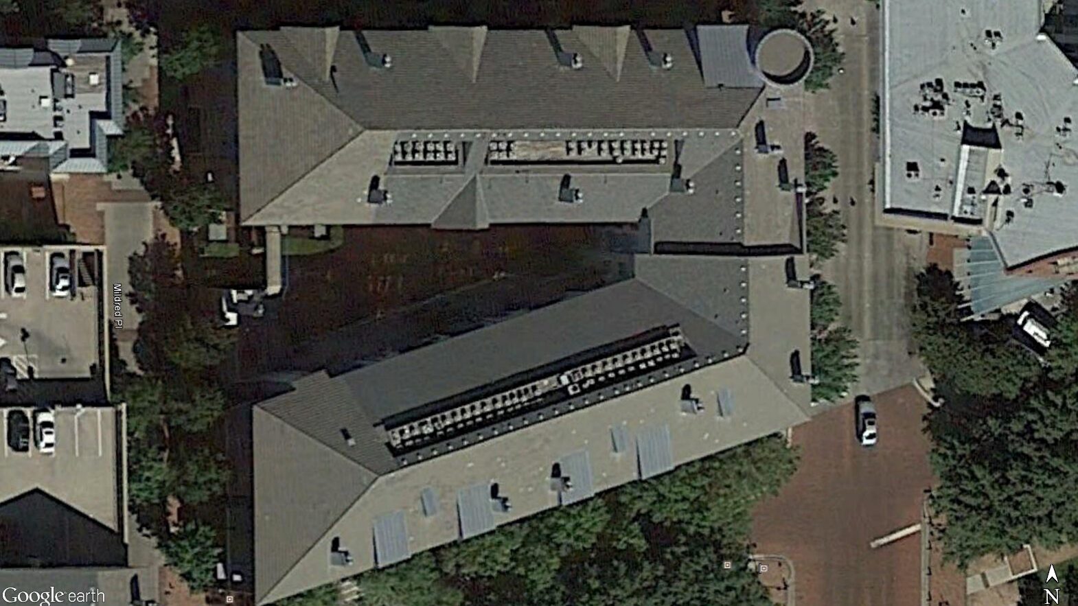
Table of Contents
- Satellite Pictures of Roofs
- Introduction
- What You Can Do with a Satellite Image
- What You Cannot Do with a Satellite Image
- Related Articles
- Useful Links for Information on Satellite Pictures and Roofs
Satellite Pictures of Roofs
Introduction
When it comes to the roofing industry, Google Earth is one of the most useful computer programs ever created. It saves an incredible amount of time for roof estimators, specifiers, and roof maintenance managers, among others.
Even roof leak repair crews can use a printout of a satellite image of the roof they’re working on to mark the exact location of a leak for the leak report and future reference.
Roofing professionals need accurate roof measurements and roof plans that show the precise location of every rooftop item (skylights, rooftop equipment, vents and other roof penetrations). These measurements and drawings have to be produced before roof estimates, budgets, work schedules, and maintenance plans can be generated.
Gathering this data used to be done on foot, on the roof, with graph paper, a measuring wheel, and a camera. For very large roofs, it could take a couple of days.
I remember when I first found Google Earth. I was sitting in my office in 2005, scheduling visits to several large commercial roofs we had just added to our roof management program.
I needed to perform initial roof surveys to identify the existing roofing, rooftop equipment, etc., so I could draw the accurate roof plans that were the first step in creating a file on every roof in our portfolio.
I was getting ready for two mildly unpleasant weeks walking roofs in the Texas sun. I remember thinking “there has to be a better way”.
I started doing Google searches for “draw a roof plan”, “measure a roof”, and other promising phrases. One result led to another and I ended up on the Google Earth home page. And there it was. Satellite images! Satellite pictures of every roof in Texas!
I still ended up walking those particular roofs for the next two weeks. But the next time I had to do an initial roof survey, all I had to do was check the condition of the roof, take a few baseline measurements, and take pictures. Defects and other issues could be noted right on the printout.
Having a printout of the satellite image reduced the time I had to spend on the roof by around 70%. That’s something.
What You Can Do with a Satellite Image
In order to use a satellite image of a roof effectively, you really need to be familiar with roofs in general so you’ll have an idea of what you might be looking at.
For example, it does no good to say a satellite image can show you evidence of ponding water on a roof if you don’t already know what evidence of ponding water would look like if you were standing on the roof.
Learning to read satellite images correctly takes some practice, as well. It’s a skill. And even with professional-level roofing knowledge and practice reading satellite images of roofs, it’s still not always clear what you’re looking at because the images are simply not detailed enough.
More than once, I’ve seen two veteran roof estimators argue about what they were looking at on a satellite image printout of a roof during a pre-bid meeting.
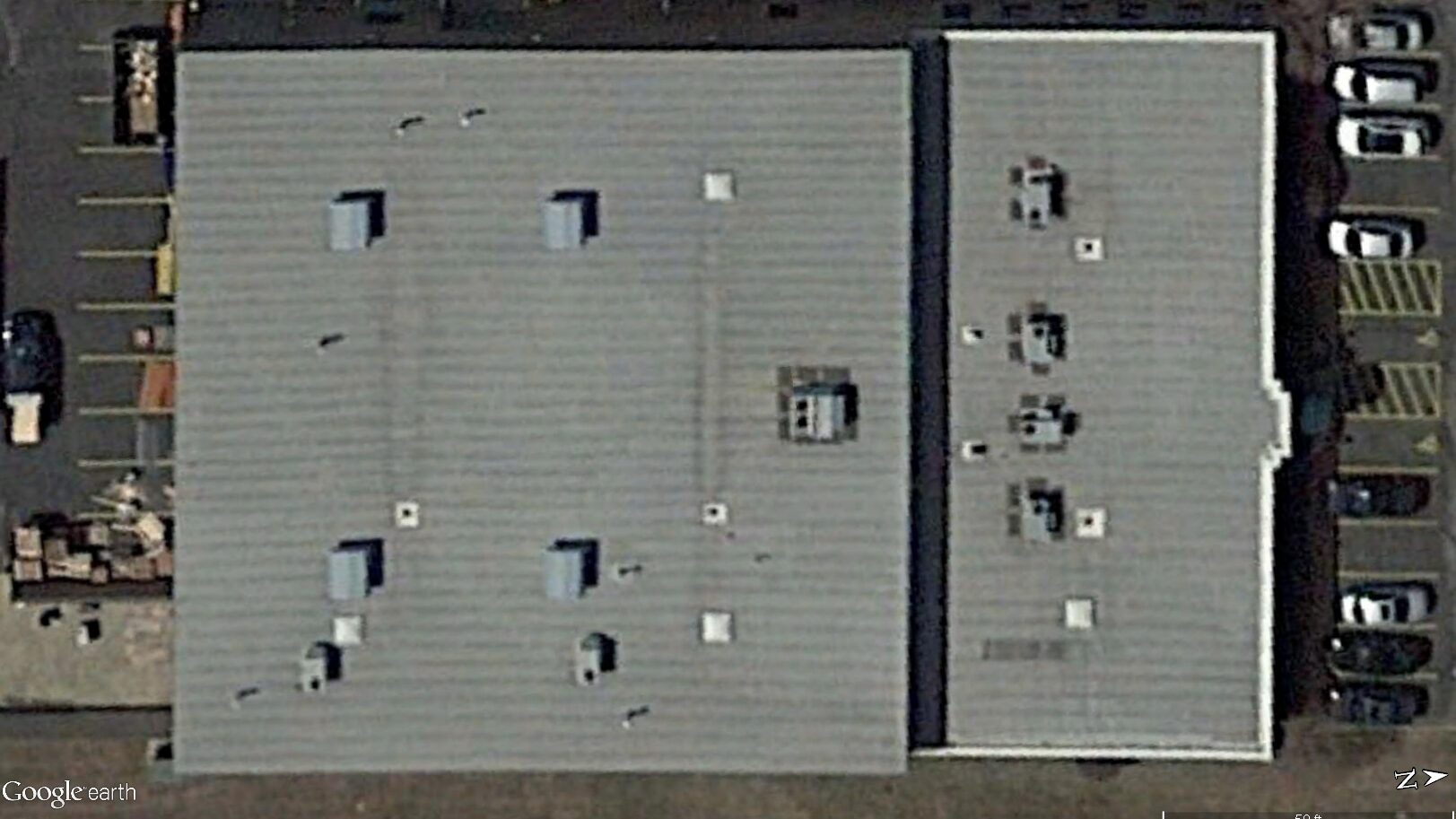
Here are some of the things you can do with a satellite image once you know what you’re doing:
Measure roof distances and areas to a useful degree of accuracy.
Identify many types of roofing.
Identify and measure roof hips and valleys.
Identify and count the number of smoke vents or skylights.
Count the number of HVAC units.
Count and locate the roof drains.
Identify areas with persistent ponding water.
What You Cannot Do with a Satellite Image
Measure roof areas and distances with precision.
Measure the slope of a roof.
Identify every kind of roof.
Identify every type of rooftop unit.
Tell what’s underneath the existing roof covering.
Related Articles
Useful Links for Information on Satellite Pictures and Roofs
1. General: Google Earth Pro is now free. The download is available at the Google Earth website. Take advantage of the full range of measurement tools that you used to have to pay for.
This is great. For one thing, you can zoom in on the roof and use the polygon measuring tool to plot the perimeter of the roof and get a usefully accurate total square footage (for “flat” roofs; sloped roofs are a little more involved, but we can help you figure out the surface area of a sloped roof).
Zoom in on the roof, then select “Tools” at the top left, then select “Ruler”. It’s pretty self-explanatory after that. If the angle changes too much when you zoom in, go to “View” at the top left, then click on “Reset” at the bottom of the drop-down menu, then click “Tilt”.
2. General: Finding a roof: If you are trying to see a good, close-in satellite image of the roof on a specific building, see Roof Online’s page “How to Find a Building on Google Earth (and see a good close-up of the roof)”.
3. General: Measuring a roof: For help using the measurement tools on Google Earth Pro, see Roof Online’s article: “How to Measure a Roof with Google Earth“.